Exploring upper Copper and Indian creeks for yellow-cedar
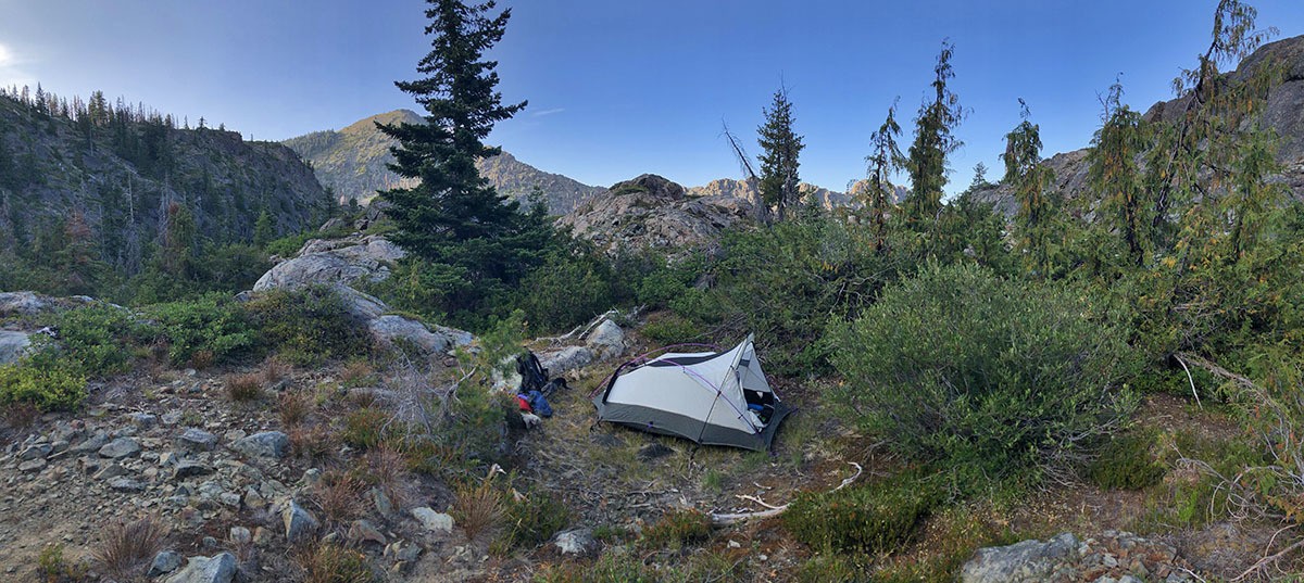
I have been mapping and inventorying yellow-cedar (Callitropsis nootkatensis) in California for the past four years. This process could have been much more efficient if it wasn’t for the 2018 Eclipse Complex and the 2019 Natchez Fire (more below) that virtually closed the Siskiyou Wilderness for the past two summers.
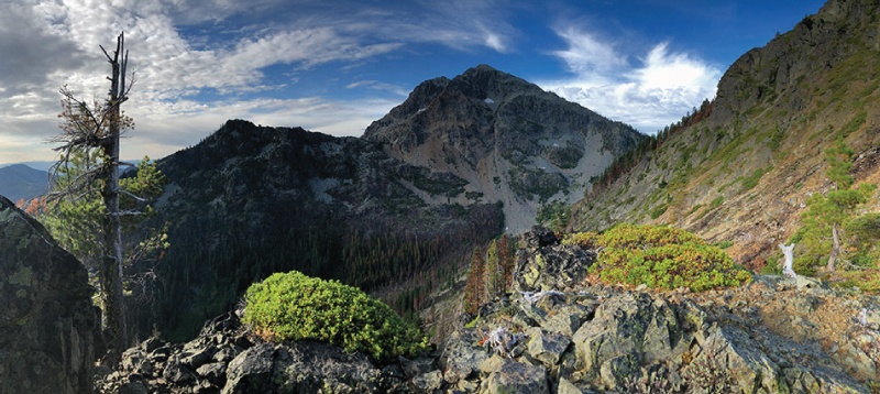
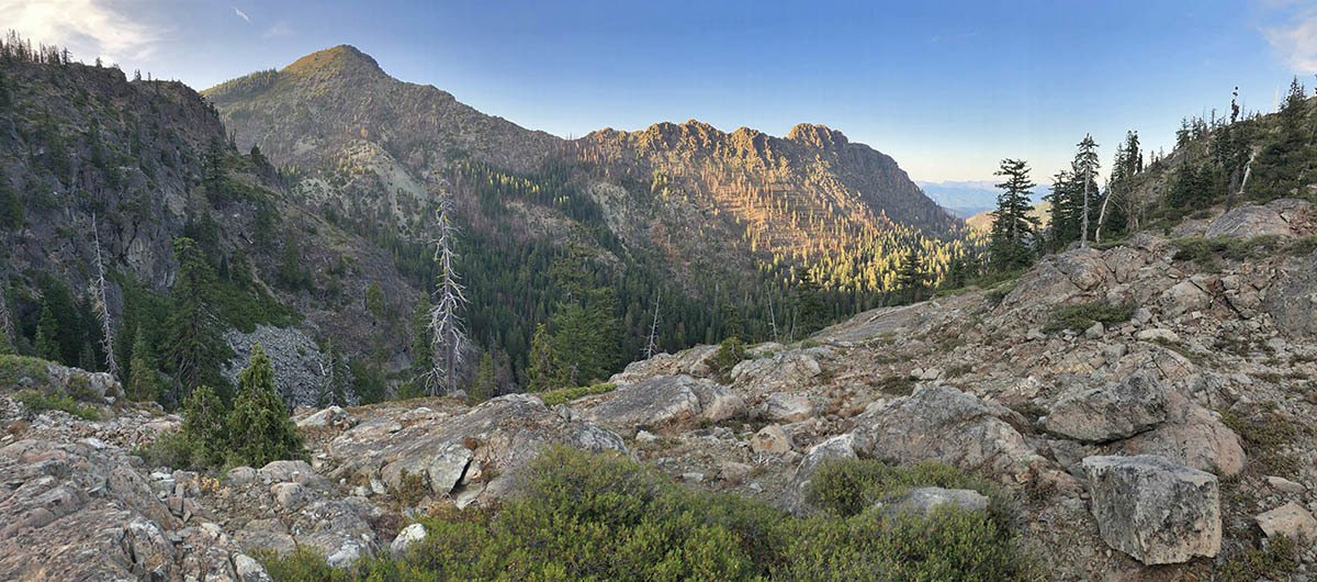
Successful surveys before this year have doubled the previously known area of this rare conifer from approximately 5 hectares in 2015 to 11 hectares by 2018. One of the largest gaps in surveys was within upper Indian and Copper creeks in the Klamath River watershed. I predicted this is where the largest stands of the species would be–little did I know how large an area I would find.
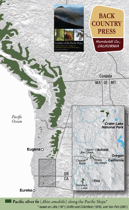
In conjunction with the Klamath National Forest and the California Native Plant Society Vegetation Team, I began a mapping and inventory project for Pacific silver fir (Abies amabilis) in California. The first part of this project was along the Siskiyou Crest, near the Oregon-California border. Later this summer I will visit the other population in the Marble Mountain Wilderness.
Pacific silver fir in California can easily be overlooked because of its similarity to white fir (Abies concolor). Upon close inspection (and by going to specific locations) the differences will become apparent. Silver fir is identifiable in the hand because it has the most distinct and exuberant stomatal bloom of any regional tree. Like grand fir (and regionally white fir) the tips of the needles are notched. The needles splay from the branch on only one side often in a perfect arrays, fanning out in a semi-circular manner. The needles occasionally twist in this array, thus offering distinct silver flashes of the stomatal bloom on the undersides—a brilliant contrast to the dark-green upper surfaces. This is also what sets it apart from white fir, with a duller stomatal bloom. As with other Abies, the smell of crushed needles emits a resinous “pine scent.” The bark is distinct, forming long, narrow, rectangular blocking patterns that seem to melt off the trunks in silvery chunks with subtle reddish hues in the furrows. At a distance, larger trees are gradually tapered, similar to Shasta fir (Abies magnifica var. shastensis). It is an inimitable and rare experience to spend time with this beauty in the Klamath Mountains
For the better part of July I was contracted by the Forest Service Region 5, in a partnership with the CNPS Vegetation Program, to follow up with our 2013 work mapping and monitoring whitebark pine in the north state. I visited numerous sites where I predicted Pinus albicaulis might occur to conduct surveys and improve our state-wide range map for the species. Overall, the health of the species in northern California is in slow decline due to a variety of factors including mountain pine beetle, white pine blister rust, global climate change, and recent high intensity fires. In an earlier post, I shared some highlights from the Modoc National Forest, this post shares images and highlights from Klamath National Forest whitebark pine work.
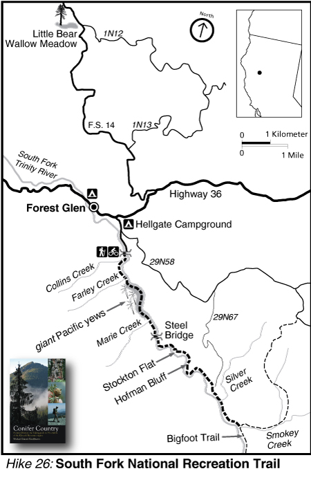
Botanizing the South Fork National Recreation Trail – Trinity County
Hiking Hell Gate
Hell Gate highlights the lowland interior forest of the southern Klamath Mountains along the Trinity River on the Shasta-Trinity National Forest. The Trinity is surely one of the most spectacular rivers in the state and this hike is along a roadless stretch in the upper reaches of the south fork. The old-growth Douglas-fir/mixed evergreen forest is top-notch, especially along the north-facing sections of trail. Oak woodlands are on benches above the river, with Oregon white oak mixing with picturesque grasslands–though the lack of fire is allowing extensive conifer encroachment. Some of the largest Pacific yew I have ever seen can be found along the trail as well.
The area is dotted with private in-holdings and these beautiful old homes appear at random intervals along the trail. The trail is open to biking and—for these home-owners—OHVs. Swimming opportunities abound and solitude can be easily found, especially in the winter (there are bridges on all major stream crossings). The hike, as written and drawn in Conifer Country, is 7 miles to Smokey Creek but the National Recreation Trail extends the length of this roadless stretch of river—for a total of 15 miles from Hells Gate to Wild Mad Road. The upper reaches of this trail is part of the Bigfoot Trail.
I am highlighting three species below that I found on our hike. One that is a regional endemic, one that reaches it coastal range extension here, and a third that is found across the northern hemisphere. These selections highlight the regional diversity with a biogeographical perspective.
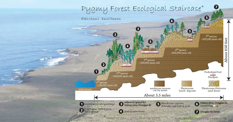
In 2012 I first visited the marine terraces of coastal Mendocino County and was captivated by what I learned. The blog and graphic I cooked up after that visit has been one of the more popular entries on this website. In fact, the United States Geological Survey recently published a document on the Marine Terraces of California that features:
How marine terraces form
Soils sequences of California’s terraces
Where to find marine terraces of California
The main graphic from my blog about Mendocino’s ecological staircases