Original Publication DATE: 10/24/2010
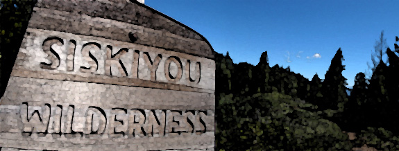
With the threat of our second significant storm of the season looming, I packed the truck and headed into a mysterious and isolated region of the Siskiyou Mountains to find two rare groves of trees and enjoy the transition toward winter. The roads are long and lonely leading south from Oregon’s Applegate Valley into the high peaks of extreme southern Oregon and northern California. This region drains the headwaters of the Applegate River where nebulous state borders are crisscrossed by wild mountains, rivers, and the occasional road. This is surely the quintessential ancient meeting ground where rare plants have hidden out for millenia–optimal environmental conditions are fostered with a unique balance of sun, soil, and water. In addition to the rare conifers under discussion one might also encounter Pacific silver-fir, subalpine fir , Brewer spruce, and Port Orford-cedar close by–not to mention the other more common species.
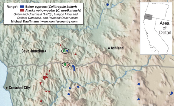
- This map shows the only region in the world where the northern-most native cypress (C. bakeri) overlaps with Alaska yellow-cedar (C. nootkatensis) in its southern range extension.
One quick side note with respect to the genera I present here (without getting overly detailed)–several classification schemes currently exist for these species. Alaska-cedars have been placed in one of five genera by various sources: Cupressus, Chamaecyparis, Xanthocyparis, Hesperocyparis, and Callitropsis. Needless to say, things are a bit up in the air. While these names have yet to be worked out what has transpired, for now, is one of three scenerios:
Continue reading “Siskiyou cypress and yellow-cedar in the Klamath Mountains”