I first created a map set for the trail in the winter of 2009 after hiking the trail the previous summer. It was a fun, first attempt for me to create something like this. I offered the digital map set & route description for free the past 6 years (find original map set here). During that time, hundreds of folks downloaded the file. Some of those even hiked the trail, providing me feedback on the original description. With the launch of my grand plan to establish the Bigfoot Trail Alliance, I decided it was time to revamp and update the previous document.
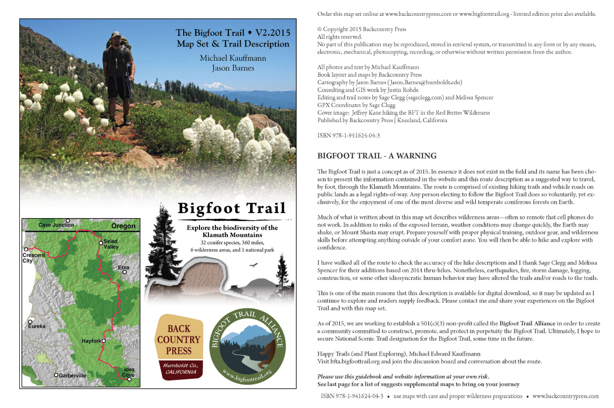
That original file got a major overhaul this spring with the help of a terrific cartographer, Jason Barnes. He and I worked out a template for the route and then created 23 brand new maps. At a scale of 1:60,000, where one inch is a mile. The description has a new, more user-friendly look and Jason’s map layers are second to none for both beauty and navigability.
Here are the details from the cover page of the new map set:
All photos and text by Michael Kauffmann
Book layout and map details by Backcountry Press
Cartography by Jason Barnes
Consulting and GIS work by Justin Rohde
Editing and trail notes by Sage Clegg and Melissa Spencer
GPX Coordinates by Sage Clegg
Published by Backcountry Press | Kneeland, California
ISBN 978-1-941624-04-3
Take the maps for a walk (long or short) and enjoy one of the most biodiverse temperate coniferous forest on Earth.

I am curious about the file format. The webpage just describes it as “digital file.” Is it a single pdf with both the map and guide or are they separate files like a .kmz and an epub.
I guess what I really want to know is if this map can be loaded onto a gps device and taken into the field or if I am going to need to print the whole thing myself in order to use it.
Thanks,
Daren- We offer several options. GPX track comes with a membership and we recommend using with the GAIA Earth App. At the $50 membership you get unlimited access to GPX and digital PDF map. Both will be updated in early March too, FYI. We have a few new route options that will be included. We also offer a printed map set for $45. Thanks for your interest in the trail!