There’s a quiet magnetism in Research Natural Areas (RNAs)—pockets of protected wild that call to those of us who seek to understand the living mosaic of California. These places are often the last intact natural systems on our public lands—and for decades, I’ve been drawn to them, trekking into these living sanctuaries to witness nature in its most undisturbed form, to document its story, and to carry that story forward.
North America holds two of the most species-rich temperate forests in the world: those of the southern Appalachian and Klamath mountains. What do these locations have in common? Glaciers and seas did not completely cover them during the Cenozoic and the mountains were monadnocks, or islands above the plains, offering temperate refuges to plants and animals over time. Both locations have historically maintained a moderated climate. These areas are beyond the southern terminus of the enormous continental ice sheets of the Pleistocene. Some plants undoubtedly remained in these regions through historic climatic change, while other species repeatedly moved in as climate cooled and glaciers pushed southward and then moved out following glaciers northward. These dynamic fluctuations have cradled plant diversity in these two unique regions.
The current consequences of these historical patterns are that the Klamaths and southern Appalachians have grand floristic diversity, a concentration of endemic plants, and a fundamental importance to the forest floras of nearby regions (Whittaker 1960). Per unit area, the Klamath Mountains and the southern Appalachian Mountains hold more plant taxa than any others in North America. Plant genera such as Cornus (dogwoods), Asarum (wild ginger), and various conifers (Pinus, Abies, Thuja, Chamaecyparis) grow a continent apart while providing a comparative glimpse of an ancient flora.
My family and I made a Connecticut “migration” in July of 2014 to visit family near New York city. While I was looking forward to family time, I wondered if there could possibly be and natural, wild space anywhere near the largest population center in the country. A google search revealed that Connecticut does indeed have a few Natural Landmarks that preserve and celebrate the states geological and ecological heritage. I picked one to visit that was relatively close to our “home” as well as one that celebrates one of the most ancient lineages of plants on Earth – a conifer!
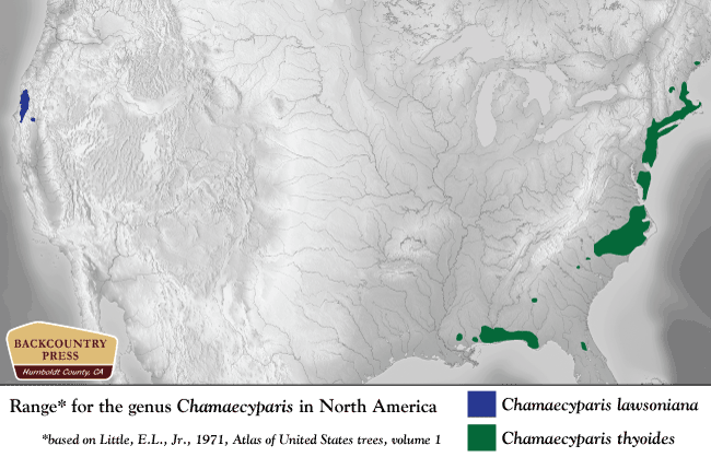
Chamaecyparis in North America. Atlantic white cedar (Chamaecyparis thyoides) is geographically restricted to freshwater wetlands along the eastern coastal United States.
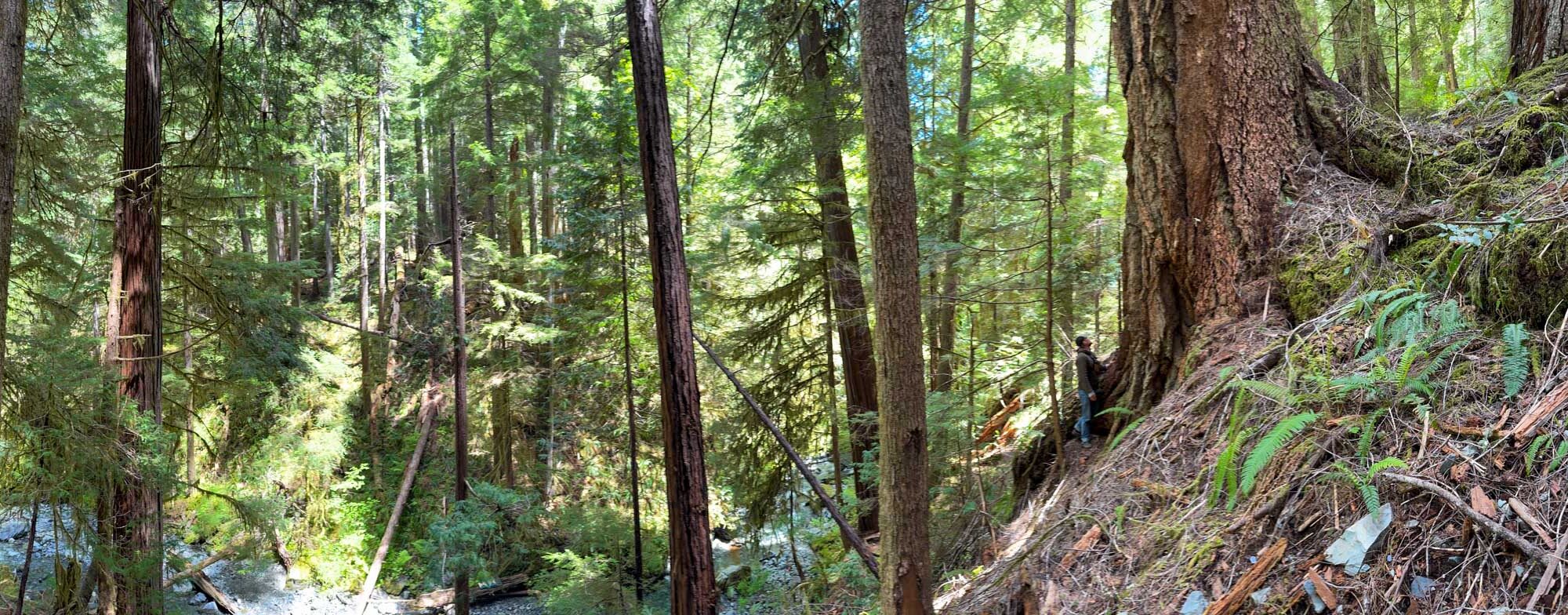
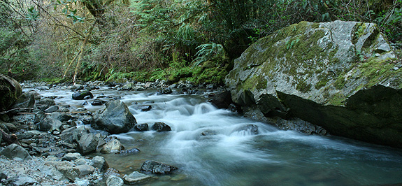
Situated on the border of two major rock types, Myrtle Creek Botanical Area is floristically challenging as well as aesthetically arousing due to this unique geological architecture. Along the western slopes of the Myrtle Creek drainage, the North Coast Range meets the Klamath Mountains against an ancient island-arc accretion known as the Josephine Ophiolite. Plant communities are often defined by rock type, and this juncture creates unique plant assemblages. It is a place where complex rock interacts–nutrient rich soils of Coast Range meets the nutrient poor serpentines of the Josephine Ophiolite. It is also a place where ample rain falls, often in the amount of 100 inches per year. Because of these complex abiotic interactions, plants touch roots with plants in associations that almost never occur. For example, redwoods (Sequoia sempervirens) grow with pitcher plants (Darlingtonia californica) and western redcedars (Thuja plicata) with knobcone pines (Pinus attenuata).
Historically, the drainage saw major mining operations transform the landscape when placer mining (panning) in the late 1800’s gave way to the more destructive–and potentially more lucrative–hydraulic mining during the early 1900’s. Eventually, all the accessible gold was removed and as the miners left the landscape, it slowly recovered. Today, all that remains from the operations is a major sluice where the trail begins, a ditch upon which the trail is built as well as several old shafts that are fenced in for protection.
The plants have returned and, with a few exceptions, are flourishing. The wildflowers begin in mid-March and continue into early June. Orchids, trilliums, azaleas, rhododendrons, mustards, buttercups, sorrels, wood roses, huckleberry, and more create a rare botanical legacy of unique associations–ready for exploration and self-discovery. Located within the Smith River National Recreation Area, the trail has interpretive signs to aid your discoveries along the 1+ miles to the creek.
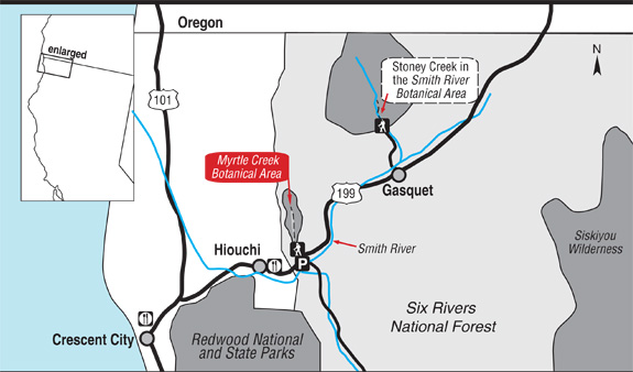
Map to Myrtle Creek Botanical Area in the Six Rivers National Forest.
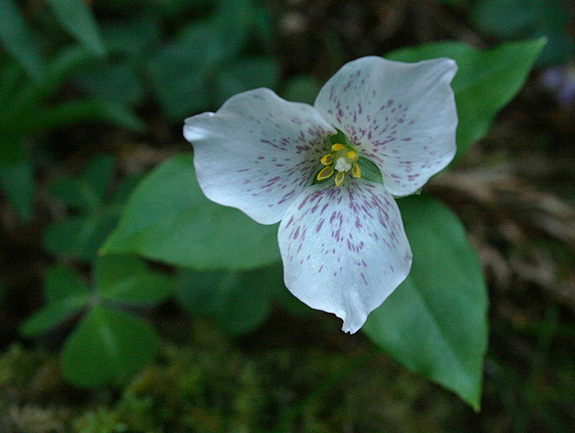
Brook wakerobin (Pseudotrillium rivale)
Myrtle Creek
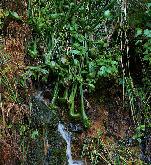
Darlingtonia californica (by Allison Poklemba)
Pictured above is California pitcher plant (Darlingtonia californica) growing on serpentine, which is not unusual in Del Norte County. What is unusual is that along Myrtle Creek it associates with salal (Gaultheria shallon) which is in the picture and growing just above–casting shade–is a redwood tree.
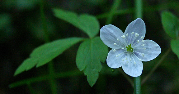
Anemone quinquefolia
Other Resources:
North Coast CNPS Page for Myrtle Creek Botanical Area
—– COMMENT: AUTHOR: Sue DATE: 4/24/2014 4:18:08 PM You said: “… a ditch upon which the trail is built…” This was no ditch, but a carefully constructed Chinese Footpath – the kind a person would see in Vietnam, Cambodia, Laos, or other Asian rainforest areas. In addition to a mining camp was a Chinese labor camp. They built the footpath – which used to extend from near the falls to what is now hwy 199. I have taken several Vietnam Veterans on this trail, and they are all amazed at the similarity between this “ditch” (as you call it) and trails they saw while in Vietnam. These Chinese trails are noted by drainage area on the ‘mountain’ side of the trail, and a berm on the “creek” side of the trail. This construction helps keep the trail intact despite wet weather. Unfortunately, after over 150 years, there have been some serious mudslides along the creek that covered portions of the footpath – making it very difficult to get to the falls. There are still gold mining claims along the creek, and in the past, these mining claims have been protected with rifles. But not any more. I love this creek, have hiked it for 40 years, and treasure the botanical life. But a well-maintained trail would be nice. I would love to be able to hike to the falls again on a real trail.
Sue- Thanks for the comment. Sounds like you have a great understanding and appreciation for this wonderful creek canyon. I am sorry if I offended you by calling it a ditch, I know better now! -Michael