Original Publication DATE: 5/16/2011
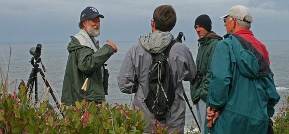
Gary Lester is an explorer. With each day’s journey he refines an understanding of the natural world that has been cultivated from an early age. Because of his keen sense of place he has made a multitude of significant ecological discoveries. Any one of these discoveries, considered alone, would be a lifetime’s achievement for some (like me) but seen together Gary’s findings are regionally paramount and set the bar high for naturalists everywhere. For example, in the fall of 2010, he and his wife Lauren identified a Brown Shike in coastal McKinleyville that created quite a stir for birders nationally (he has show this bird to people from across the North America all winter, including a man from Florida who gave him the slick Tampa Bay Rays hat he is sporting in the picture below). Clearly, Gary has a view of the world where the smallest details build the bigger picture. When a new element does not fit that picture a personal discovery is made.