Original Publication DATE: 6/7/2011
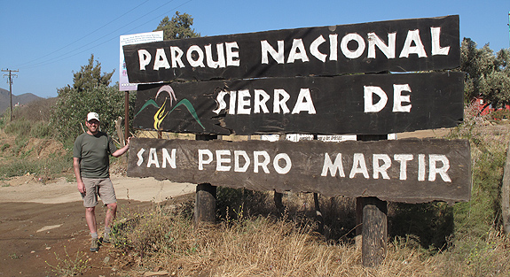
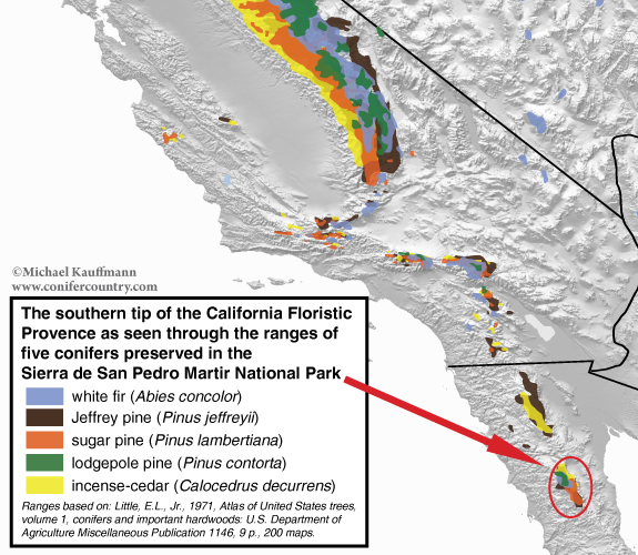
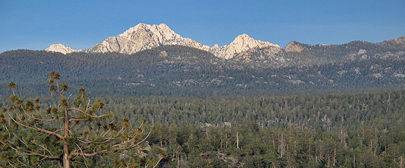
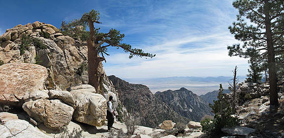
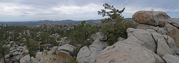
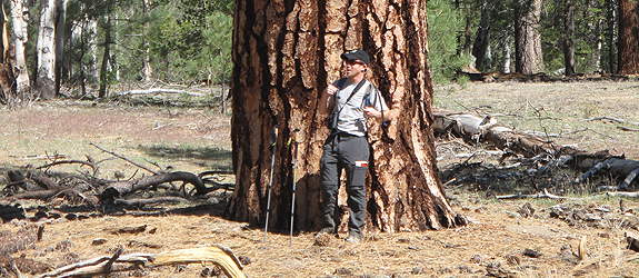
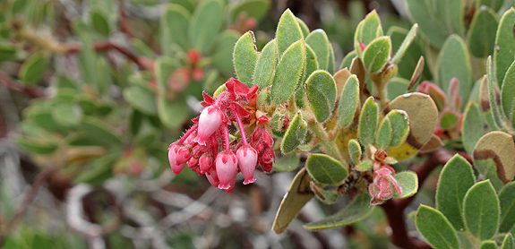
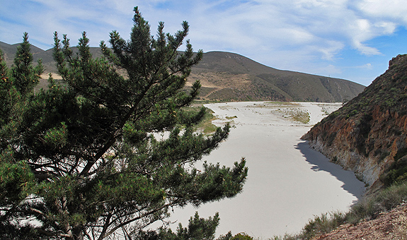
This mountain range had been a place in my dreams for many years. I had heard about its rich conifer forest, that many of the conifers (and other plants of course) common within California reached their southern range extension here, and that a natural fire regime had been ‘maintained’ by mother nature. This was an intact a forest–in as natural a state–as we 21st century explorers might hope to find. The mountains themselves are part of the Peninsular Ranges which I was quite familiar with, having lived in the San Gabriel’s for many years.
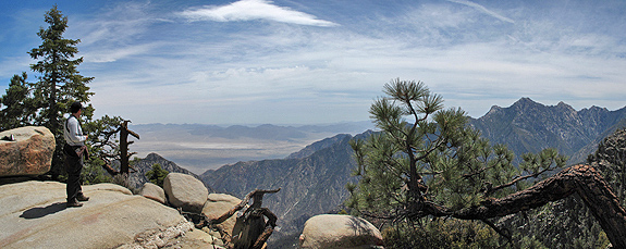
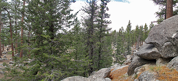
I knew it would be similar in feel to my former home yet a world away in place. The fault block range–similar in formation to, say, the Sierra Nevada–allowed a nice gradual climb from the west where we enjoyed desert scenery which slowly transitioned to pinyon forest and ultimately a coniferous wonderland. On the plateau of the San Pedro we felt eerily at home as Olive-sided Flycatchers shouted “three-quick-beers” from the tops of sugar pine and white fir. Yet at the same time it was different. Millions of year of divergent evolution was at play here. Sugar pine cones were shorter, white fir needles were lighter green, and how did these birds find this place? This was an isolated sky island community with its own unique feel. These mountains offered a new twist and a better understanding of old friends. I can now say that I (anthropocentrically) comprehend what it is to be a white fir, sugar, lodgepole, or Jeffrey pine in the Sierra de San Pedro Martir. What an amazing National Park.
On the return…
Salsipuedes Gringos
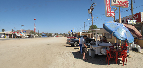
Mitch and I (along with our families) were worried about entering Mexico because of some of the news we had been hearing recently. With the assurance of several friends who had made recent trips we took the leap, crossed the border, and had an excellent journey. The people were friendly and accommodating and the roads were in good shape and safe to travel.
On our return we passed the town of Salsipuedes which translates to “get out while you can.” While this thought was in the back of our minds on the way down, on our return I could only think–when can I get back?
COMMENT:
AUTHOR: Joyce Grunewald
DATE: 6/7/2011 2:39:26 PM
Michael~ As always, great pictures & narrative. I especially am most grateful to know you are back in the USA.
Su Madre
—–
COMMENT:
AUTHOR: Gambolin’ Man
URL: https://gambolinman.blogspot.com
DATE: 6/7/2011 2:43:30 PM
Michael,
Great write up and photos of a mysterious place I’ve never been to but have known about and read about for a long time. I first heard of it in some Ed Abbey ramblings when he and some buddies went there. Very cool!
—–
COMMENT:
AUTHOR: John Soares
URL: https://northerncaliforniahikingtrails.com/blog/2011/01/30/risky-hike-ostrich-peak/
DATE: 6/7/2011 3:04:25 PM
Very interesting post Michael. I’m struck by the similarities to the eastern Sierra Nevada, as you discussed.
And it’s good to hear you had a safe trip. I’ve thought about visiting Mexico, but have been concerned about the drug-war violence.
—–
COMMENT:
AUTHOR: Michael Kauffmann
DATE: 6/7/2011 10:11:47 PM
Do you remember what book Abbey wrote about his trip to the San Pedro Martir? I had a vague recollection but can not place it. Maybe the Time-Life series about the southwest desert? Suppose I could google it, but hey…
—–
COMMENT:
AUTHOR: Miguel Vieira
URL: https://miguelvieira.org/rememberedearth/
DATE: 6/8/2011 12:53:22 AM
Really nice, Michael. It’s interesting to see the strong similarities between the Sierra de San Pedro Mártir and the San Gabriel Mountains.
—–
COMMENT:
AUTHOR: Bob Lockett
DATE: 7/26/2011 5:54:19 PM
Great article, Michael, and fascinating country. So what was the OTHER life bird?
—–
COMMENT:
AUTHOR: Michael Kauffmann
DATE: 8/6/2011 3:20:39 PM
Bob- the other was a condor a saw a few days before:
https://www.michaelkauffmann.net/2011/05/27/lifer.aspx
-Michael
—–
COMMENT:
AUTHOR: Frank Callahan
DATE: 8/24/2011 5:17:11 AM
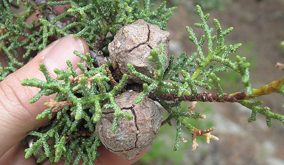
Hi Michael, Great pictures however you missed a whole scad of conifers. Pinus quadrifolia, P. monophyllus subsp. californiarum, P. attenuata, P. coulteri and Juniperus californica. In fact both the pinyon & cypress are near the summit at 10k feet elevation on Pichaco del Diablo. One hell of a climb. If you get out to Guadalupe Island add Pinus radiata var. binata and if you make it to the Cape region add Pinus lagunea. The San Pedro Martir, named for Mexico’s only black saint is like the Sierra Nevada without the Californication. I made over a dozen trips to Mexico, the pine epicenter of the planet and it’s a great place to visit prior to the drug trade. Keep up the good work and glad to have you back home. Cheers, Frank Callahan
—–
COMMENT:
AUTHOR: Michael Kauffmann
DATE: 8/24/2011 1:13:53 PM
Thanks for the information Frank. I did in fact see the other conifers you mention could be found in the San Pedro except the P. monophylla and P. attenuata. We climbed to several ridges near the Pichacho and found P. quadrifolia along the escarpment. What a place! I hope things settle down in mainland Mexico so I might visit there soon.
—–
COMMENT:
AUTHOR: Scott
URL: https://www.plantscomprehensive.com
DATE: 8/13/2012 10:16:17 PM
Any Arbutus menziesii in el parque?
Scott- Intriguing question! I didn’t see any… -MK
Thank you for sharing the details. I feel like the San Pedro Martir is in many ways more like the San Jacinto Mountains than the San Gabriels, both geologically and ecologically. It especially evident at the lower elevations of course, where there are Sonora communities on the desert side and peninsular chaparral (i.e. ribbonwood and parry pinyon) on the Pacific side, communities lacking in the San Gabriels. I wonder though about limber pines and why they are not found in the Martir along with the lodgepole pines. Maybe they once lived there but are now locally extinct. I remember seeing lodgepole pine down in La Tasajera at about 7700 feet elevation, much lower than in the San Jacintos or San Gabriels where those trees generally occur above about 8600 feet. My guess was that there was something about the Tasajera meadow soil that promoted their niche. Also, I found cypress trees in the drainage beneath scout peak/botella azul as well as on the botella azul summit (9600+ feet) where they grow with aspen and lodgepole pine, all in a sort of krumholtz form. I also found a number of larger cypress growing in an arroyo above La Encantada at about 7400 feet, which gives some idea of their range limit.