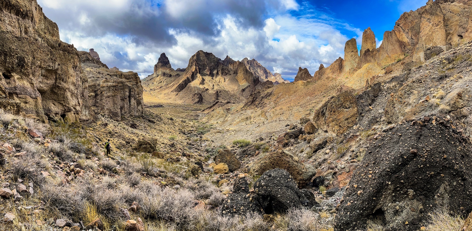
In my twenties, I basically lived in the desert — just outside of the Mojave at 6,000′ in the San Gabriel Mountains. I was minutes from Joshua trees (Yucca brevifolia) that define a particular charm in the Mojave Desert . I spent many winter weekends wandering the Sonoran and Mojave deserts of California and Arizona. It was dreamy.
After moving north to the temperate rainforest of Humboldt County to pursue a more stable career and more conifers, the desert has become a less common destination. I have been back a few times but, honestly, not enough.
With 50 on the horizon, a few of my friends decided to meet up in Las Vegas and get into the desert as fast as possible. We spent time in the Mojave-Sonoran transition zone south of I-40 and could not have been happier–walking washes and scrambling through canyons. We saw new plants, plenty of rain, and reflected on our first half century around numerous campfires.
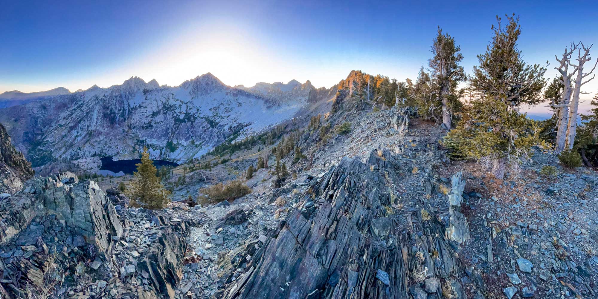
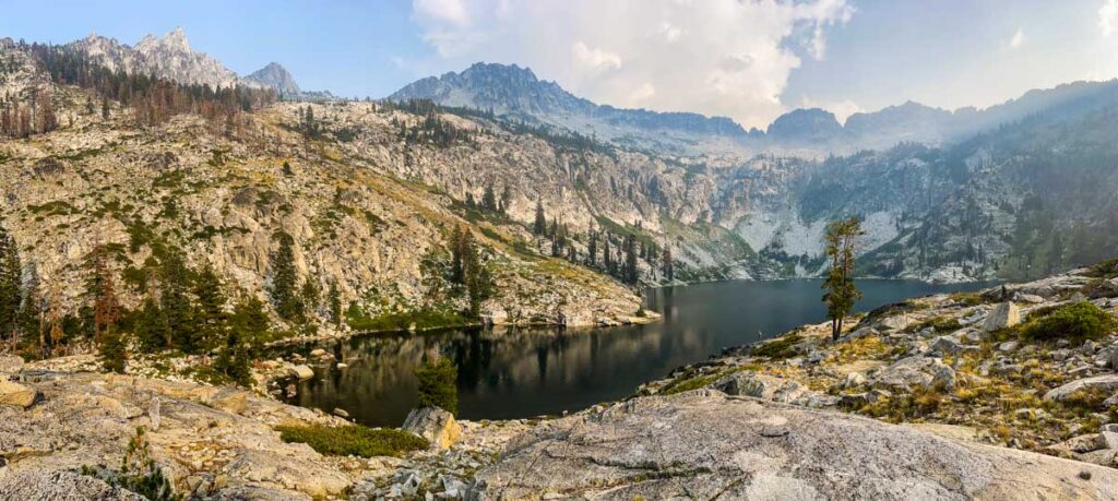
In November 2008, I made my first trip to Papoose Lake in the Trinity Alps Wilderness. That trip inspired my first blog post which evolved into Field Notes From Plant Explorations. This first post was more about geology than plants because of the unique geologic character of the Papoose Lake Basin.
This month, almost 15 years later, I returned to Papoose Lake to conduct vegetation surveys as part of our Klamath Mountains Vegetation Mapping Project. In many ways the basin is the same but in others changes are afoot. What follows are some reflections on 15 years of blogging through the eyes of a Klamath Mountain lake basin.
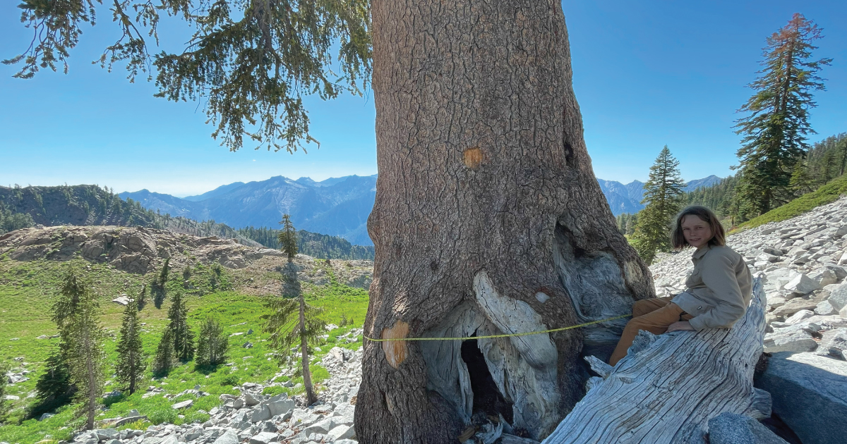
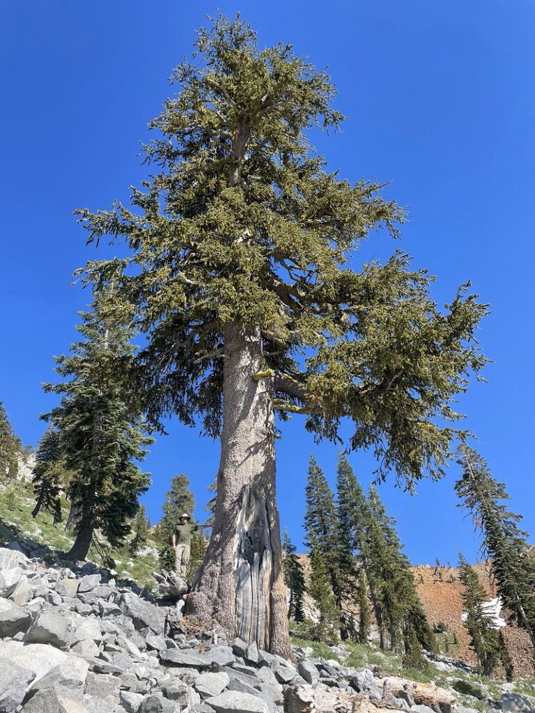
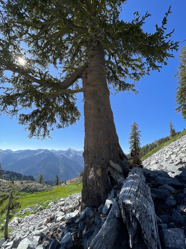
In 2010, I first found this tree while backpacking through the Trinity Alps Wilderness in far northern California. Just last week, thirteen years later, my son Sylas and I returned with tools to officially measure and nominate this tree. While points fell just short of the overall champion, it is the second largest foxtail pine known and the largest of the subspecies of the Klamath foxtail pine (Pinus balfouriana subsp. balfouriana).
I am slowly learning about some of the shortfalls my training as a western scientist has had on my ability to interpret vegetation communities of the Klamath Mountains. What I am learning, that was never properly taught in my schooling, is that everything we see today in the Klamath Mountains was affected, to some degree, by long-term human habitation over the past ~9,000 years. For example, up north in British Columbia’s coastal temperate rainforest Fisher et al. (2019) found that the plant communities around village sites had different plant assemblages than control sites and were dominated by plants with higher nutrient requirements and a cultural significance. Consider this next time you look at an oak woodland on a river bench
Another major misconception taught in western science is the description of the assumed wild and wilderness as absent of human impact–when this is far from the truth. Much of what we have designated as wilderness was sculpted by Native People’s stewardship. For example, numerous travel routes were maintained for securing basketry, medicine, food resources, or reaching ceremonial sites (see map below).
“Whether old or young, sheltered or exposed to the wildest of gales, this tree is ever found irrepressibly and extravagantly picturesque and offers a richer and more varied series of forms to the artist than any other conifer I know of.”
−John Muir
Epic grove of Klamath foxtail pines above East Boulder Lake.
The following excerpt is from my book Conifer Country. I was inspired to publish it here after a recent trip with my son to visit and measure the Klamath Mountain champion foxtail pine. After this trip, the foxtail pine is his favorite tree species too 🙂
Klamath foxtail pine range map from Conifer Country.
California’s endemic foxtail pines have established two esoteric populations abscinded by nearly 500 miles of rolling mountains and deep valleys. The species was first described by John Jeffrey near Mount Shasta in 1852 , which was most likely a population near Mount Eddy or in the Scott Mountains. Later, this species was discovered in the high elevations (9,000’-12,000’) of the southern Sierra Nevada. The ecological context of Klamath foxtail pines in the Klamath Mountains differs drastically from that in the Sierra Nevada due to the divergence of these populations in the mid-Pleistocene. Though separated over one million years ago, both subspecies exhibit a radiance and individuality for which I honor them as my favorite conifer.
With separation in space and time, divergence—including cone orientation, seed character, crown form, foliage, and even chemistry—has occurred between the two subspecies. Another reason for these variations are genetic bottlenecks that have been promulgated by spatially restricted microsite adaptations, particularly in the Klamath Mountains . Northern foxtail pines (var. balfouriana) are isolated on sky islands—local mountain tops and ridgelines—from 6,500’ to 9,000’ in the eastern half of the Klamath Mountains. By my count there are 16 isolated sub-populations each consisting of one to several isolated mountain-top populations, except in the Trinity Alps where they are locally common in the more contiguous high elevations. On these sites, proper geologic, topographic, and climatic conditions have offered synergistic alliances with shade-tolerant and faster-growing firs and hemlocks.
I have been fascinated for a long time with the conifers of the Klamath Mountains. While there are many places across the region that have a high density of conifer species, one of the hotspots is in the Russian Wilderness in an area known as the Miracle Mile. It has a long, storied history of discovery, research, conservation, and recreation.
If you visit, tread lightly and leave no trace. Day hiking is the best way to see it and preserve the unique natural features of the area. What follows is a summary of my presentation during the COVID-19 pandemic.
I learned about this project in 2014 and have been following it closely ever since. In late April, 2020 my friends Justin Garwood, Ken Lindke, and Mike Van Hattem (with other co-authors) published the first definitive paper on glaciers in the Klamath Mountains. While the news is bleak, their diligent research documents the changes in the Klamath for hundreds of years through the eyes of the highest peaks and watersheds in the range. Please enjoy the summary that follows.
In conjunction with the Klamath National Forest and the California Native Plant Society Vegetation Team, I completed a mapping and inventory project for Pacific silver fir (Abies amabilis) in California. The first part of this project was along the Siskiyou Crest, near the Oregon-California border. This post is about the populations in the Marble Mountain Wilderness.
In 2016 I embarked on a mapping and inventory project for yellow-cedar (Callitropsis nootkatensis) in California. At the time, I called yellow-cedar California’s rarest conifer. In 2019, new discoveries on the north slopes of Copper Butte and Preston Peak brought the total hectares of yellow-cedar in California to ~21 hectares. With this new data, and that collected in this project, we now know Abies amabilis is California’s rarest conifer*! See table below for stand data summary.
*This excludes the neoendemic California cypresses.
I first visited this area in 2004 when my friend Jay and I attempted an ambitious loop starting from the Wooley Creek Trailhead, to the headwaters at Wooley Lake, back to Hancock Lake, and then laboring along the non-existent trail on Steinacher Ridge back to our car. This was the first major hike I took in the Marble Mountain Wilderness and my encounter with Pacific silver fir (Abies amabilis) around the Diamond Lake – English Peak region inspired the writing of my first book, Conifer Country.
Exploring upper Copper and Indian creeks for yellow-cedar
I have been mapping and inventorying yellow-cedar (Callitropsis nootkatensis) in California for the past four years. This process could have been much more efficient if it wasn’t for the 2018 Eclipse Complex and the 2019 Natchez Fire (more below) that virtually closed the Siskiyou Wilderness for the past two summers.
Successful surveys before this year have doubled the previously known area of this rare conifer from approximately 5 hectares in 2015 to 11 hectares by 2018. One of the largest gaps in surveys was within upper Indian and Copper creeks in the Klamath River watershed. I predicted this is where the largest stands of the species would be–little did I know how large an area I would find.
In mid-September I had the opportunity to assist in guiding an EcoFlight across the North Coast and Klamath Mountains. I was invited by the California Wilderness Coalition to point out landmarks and important areas to Congressman Huffman’s staff and local media outlets as they relate to the Northwest California Wilderness, Recreation, and Working Forests Act. The following is a photo tour from the flight that highlights parts of the bill. If so inspired, please follow the links at the end to get involved!
On a recent trip into the Marble Mountain Wilderness to map and monitor whitebark pine (Pinus albicaulis) on the Klamath National Forest, I found myself near Isinglass Lake. I had read that the only population of great sundew (Drosera anglica) in the Klamath Mountains was documented here in 1972. I knew there was a Klamath Mountain peat bog to be found.
Isinglass Lake is surrounded by an accumulation of peat, know as a peat bog.
The Warner Mountains are a north-south trending fault block range in the northeastern corner of California, extending northward into Oregon. The length of the range is approximately 90 miles, with the northern California portion bounded by Goose Lake on the west and Surprise Valley on the east. In California, elevations range between 5,000-9,897 feet (on Eagle Peak). In the High Grade district, which is the extreme northern limits of the Warners in California, the range has a fairly even crest of 7500 feet, reaching an elevation of 8290 feet on Mount Bidwell. This is the area where I spent four days mapping and monitoring whitebark pine (Pinus albicaulis) for the US Forest Service.
The geology of the region is complex and compelled me to understand it better. Bedrock consists of sedimentary rocks of the Oligocene overlain by rhyolitic to basaltic volcanic rocks of the Miocene. The basal andesite is overlain by rhyolite and glassy rhyolite, which are in turn overlain by basalt flows. There are valuable minerals and gems found in this area that have justified a long-standing history of mining. Gold was the first and major extracted mineral soon followed by opals, petrified wood, and even obsidian. The range is a complex assemblage of interesting rocks for sure which help sculpt the regional ecology.
The northern Warner Mountains have a long history of mining.
It is no secret that the Siskiyous are my favorite place in the Klamath Mountains. I have spent many days and hiked numerous miles across this region. The Bigfoot Trail travels the entire crest of the range as well.
In early August 2017, lightning ignited a series of fires first named Oak, Cedar, Clear, and Prescott. These fires later grew together and were combined into the Eclipse Complex. Over the next month, approximately 100,000 acres burned in and around the Siskiyou Wilderness. Between last October and now I have had reason to visit much of this area for work and play. What follows are some of the pictures I have taken.
Coastal lowland forests of the Klamath Mountains. From the future book, The Klamath Mountains: A Natural History.
The coastal lowland forests receive the most annual rainfall of anywhere else in the Klamath Mountains. From the north in Oregon the Coquille, Rogue, and Illinois rivers drain southwest Oregon and the Smith River country is California’s only temperate rainforest. The rich soils, temperate year-round growing season, and high rainfall (often over 100 inches) nurture these impressive forests.
Klamath coastal lowland forests are typified by dense, closed canopies on well-developed soils (sometimes serpentines). The dominant tree species have high colonizing abilities, long life, and a wide ecological tolerances to environmental conditions, including dry summers with occasional persistent fog. These forest thrive below the snow belt on the extreme western slopes of the Siskiyou Mountains. Species like Douglas-fir (Pseudotsuga menziesii) and Port Orford-cedar (Chamaecyparis lawsoniana) secure the highest place in the canopy, often approaching 300’. A second canopy forms one hundred feet below and includes species like tanoak (Notholithocarpus densiflorus) and madrone (Arbutus menziesii) where they share an understory with coastal specialists like salal (Gaultheria shallon) and evergreen huckleberry (Vaccinium ovatum). With the high volumes of rain that falls each winter, banks of coastal rivers and streams are frequently disturbed and then repeatedly pioneered by red alder (Alnus rubra).
From Wildflowers of the Trinity Alps. Photo by Ken DeCamp.
Green plants are considered autotrophs because they photosynthesize—making sugar from water and carbon dioxide. The world of heterotrophic plants is complicated but all have moved away from total energy production from photosynthesis toward obtaining organic carbon either directly from other living beings or through a parasitic relationship with a fungus. Heterotrophic plants include directly parasitic and mycotrophic forms. The conifer forests of the western United States nurture an exceptional diversity of heterotrophic plants and the Klamath Mountains may have the most heterotrophic plants in the western United States!
I have begun a collaborative mapping and inventorying project for yellow-cedar in California this summer. The species is a CNPS Inventory of Rare and Endangered Plants on list 4.3 (limited distribution) in the state, with only a handful of known locations. The majority of the stands are on the Klamath National Forest but a few are also on the Six Rivers. Over the course of the summer I will be visiting a number of these populations and collecting data on stand health, reproduction, and plant associates. I made the first stop of the summer at the Bear Peak Botanical Area.
I recently started a citizen science project with 5 classes of high school biology students from Fortuna, California. The plan is to combine their observation skills with the technology offered by iNaturalist. Each month they will visit Rohner Park and record data on a chosen spot in the forest–looking for plants and animals as well as changes in canopy and ground cover. As they become more proficient in species ID, students will also upload observations to our iNatural Project ultimately creating a field guide to their local forest. We all know how much I like field guides…
My plan, over future visits to wilderness areas, is to start similar citizen science projects. The first attempt at this wide-ranging project began this week on a visit to the Bear Peak Botanical Area on the Klamath National Forest. I originally wrote about this area in my book Conifer Country because it is unique in many ways, including the populations of yellow-cedar found here. This species in common further north, but quite rare in California.
Quaking aspens (Populus tremuloides) in the Blackrock-High Rock Desert.
Fall is coming.
For me it is a time of rejuvenation and also my favorite season. With the shift of the California Current, rains begin to fall in California after a summer of drought. The high country along the Pacific Slope finds snow returning. While we retreat inside our homes, native plants and animals must adjust to the changes. Some birds migrate, mammals might hibernate, and some plants shed their leaves and “hibernate” for winter in their own way.
What follows is a journey across the Pacific Slope to four favorite fall hikes–excellent for colorful foliage. I’ve also included some of the plant species that will be found.
Siskiyou Wilderness
Pasayten Wilderness
San Gabriel River National Monument
Blackrock-High Rock Desert National Conservation Area
A view from Mount Linn toward the Pacific Ocean and the distant King Range.
Mount Linn–also called South Yolla Bolly Mountain–is the highest point in the Coast Range of northern California. It is located to the west of Corning but the area might as well be a world away from the population centers of the state; it is rarely noticed by travelers as they drive Interstate 5. Once off the interstate, scenic forest service roads still take nearly 2 hours to wind to the trailhead. I revisited this fine mountain in July of 2016 to set up a photo-monitoring plot along the Bigfoot Trail and took the time to also map the vegetation on the mountain–particularly the grove of foxtail pines near the summit. This is one of the smallest (12 acres) and most isolated groves for the entire species and one that I am very much concerned about due to climate change. Shasta firs are encroaching upon the trees as snowpack declines and temperatures warm. I was happy to see the trees doing well and many young foxtails sprouting up–just not as many as there are young firs.