In my twenties, I basically lived in the desert — just outside of the Mojave at 6,000′ in the San Gabriel Mountains. I was minutes from Joshua trees (Yucca brevifolia) that define a particular charm in the Mojave Desert . I spent many winter weekends wandering the Sonoran and Mojave deserts of California and Arizona. It was dreamy.
After moving north to the temperate rainforest of Humboldt County to pursue a more stable career and more conifers, the desert has become a less common destination. I have been back a few times but, honestly, not enough.
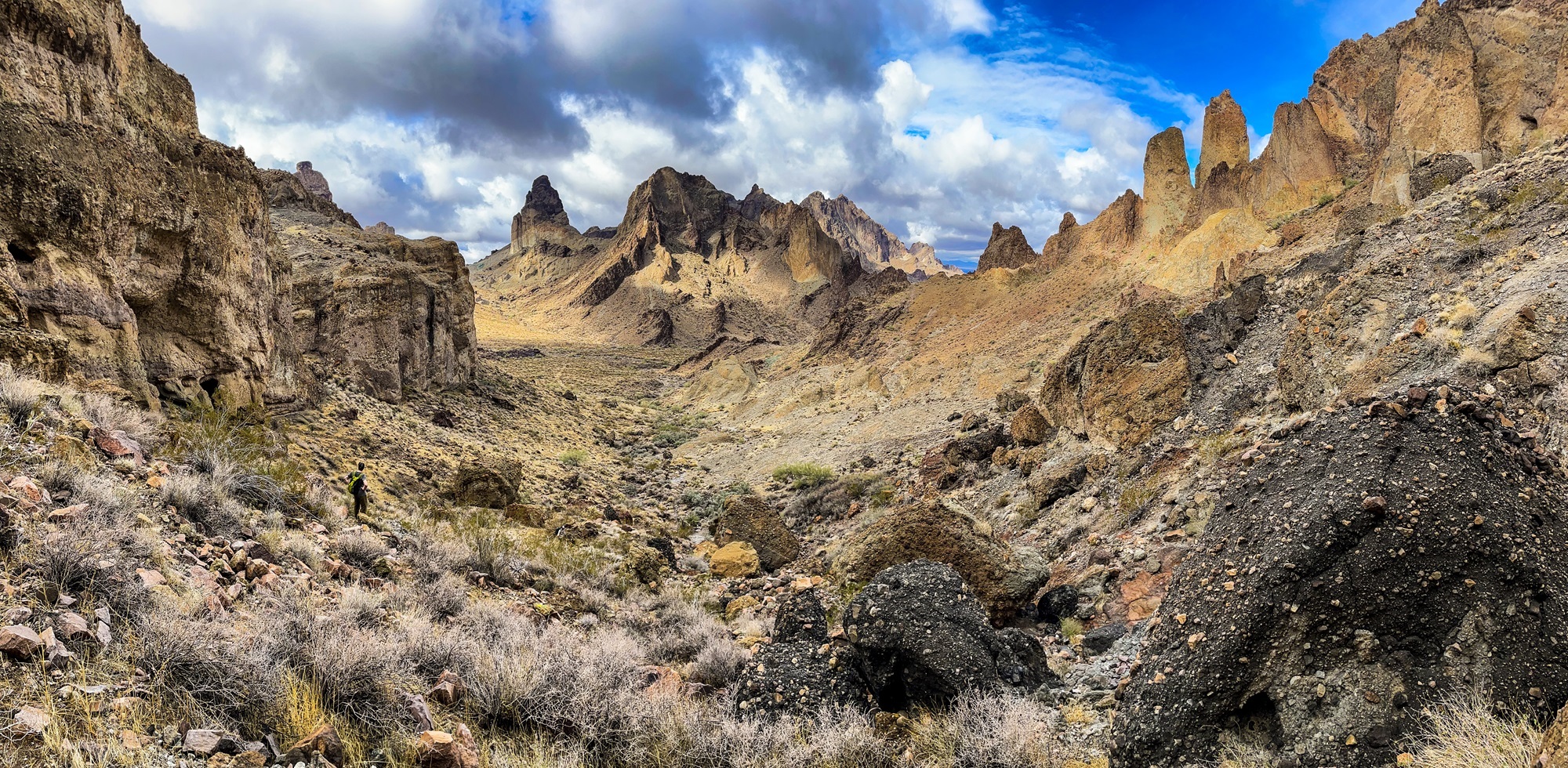
With 50 on the horizon, a few of my friends decided to meet up in Las Vegas and get into the desert as fast as possible. We spent time in the Mojave-Sonoran transition zone south of I-40 and could not have been happier–walking washes and scrambling through canyons. We saw new plants, plenty of rain, and reflected on our first half century around numerous campfires.
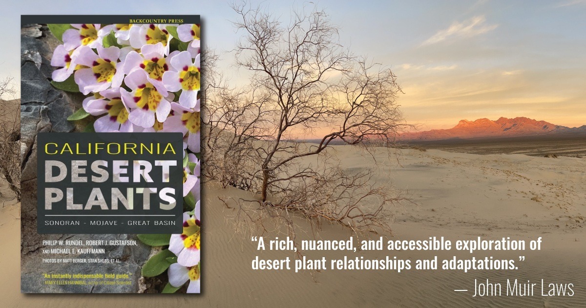
California’s deserts have always fascinated me. In the late 1990s and early 2000s I visited many areas of the Sonoran, Mojave, and Great Basin in California while teaching in Southern California. Since moving north, I have often dreamed of returning. In 2020 Backcountry Press was approached by Dr. Philip Rundel from UCLA about doing a book on California Desert Plants. This was an exciting prospect and an easy decision to make. After over a year of work (he has been working on the idea on and off for 15 years) we are excited to announce that the book is done.
California Desert Plants
For me, this book is amazing because it tells the story of one of the harshest environments on Earth. There are three distinct desert areas in California—the northwestern portion of the larger Sonoran Desert, the Mojave Desert which extends beyond the state, and the western margin of the Great Basin. A key feature of the California deserts is the dominance of infrequent rainfall in the cool winter months and general absence of rainfall and associated drought in the summer months when warm temperatures are otherwise favorable for growth. The combination of these harsh conditions nurture amazing plants with a complicated variety of adaptations.
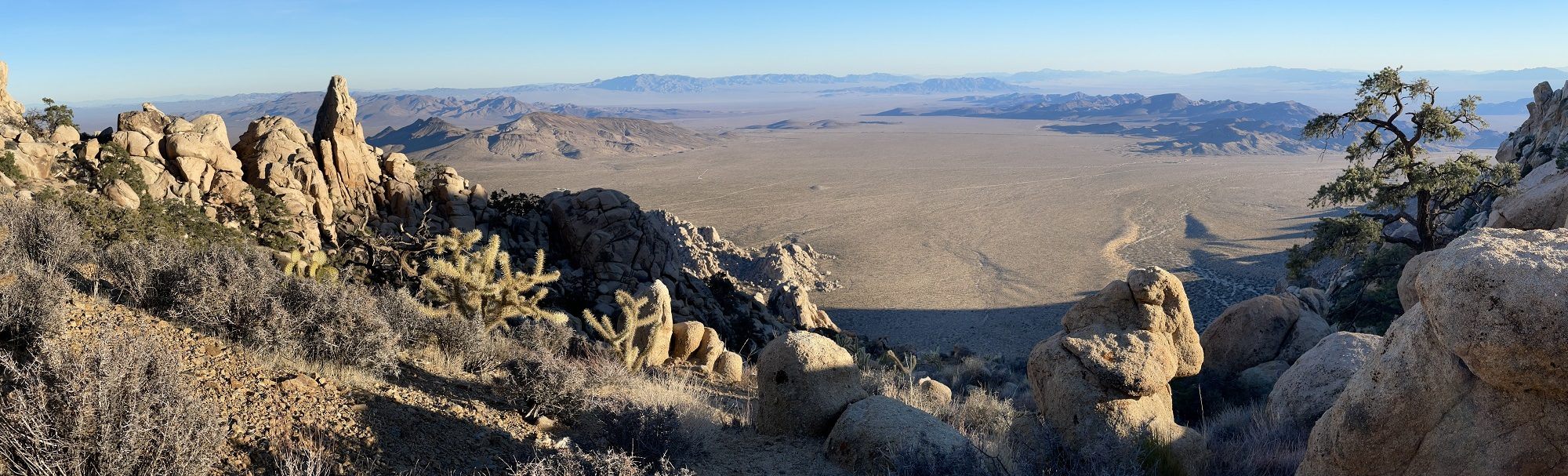
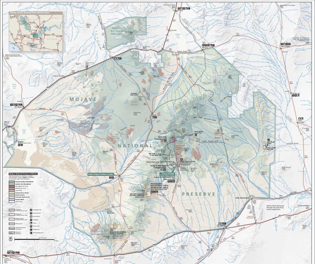
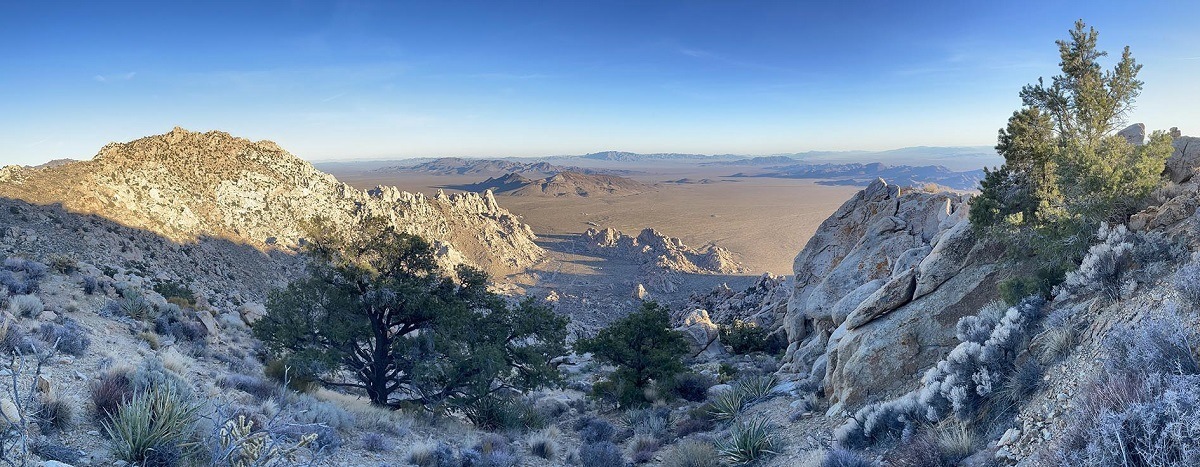
Established in 1994, the Mojave National Preserve encompasses 1.6 million acres roughly bounded by Interstates 15 and 40. Most simply pass by this region on their way to other places (Lost Wages, Nevada for example) but it is a premier desert park. This vast and varied landscape includes dunes, dry lakebeds, granites, volcanics (domes, lava flows, and cinder cones), limestones, and sedimentary deposits which support a diverse collection of plants. The preserve includes creosote bush lowlands at 880 feet near Baker all the way up to conifer woodlands at 7,929 feet on the summit of Clark Mountain. The Mojave Wilderness is 700,000 acres of the preserve.
Within the preserve is the University of California Riverside’s Sweeney Granite Mountains Desert Research Center. The University of California’s GMDRC is dedicated to academic research and teaching and access is solely through an application approval process. This was was our basecamp. I am working on a book with Philip Rundel and Bob Patterson calledCalifornia Desert Plants (Backcountry Press, late 2022) so we came to experience, explore, photograph, and write about the regional wonders. In particular, we wanted to find trees in the desert.
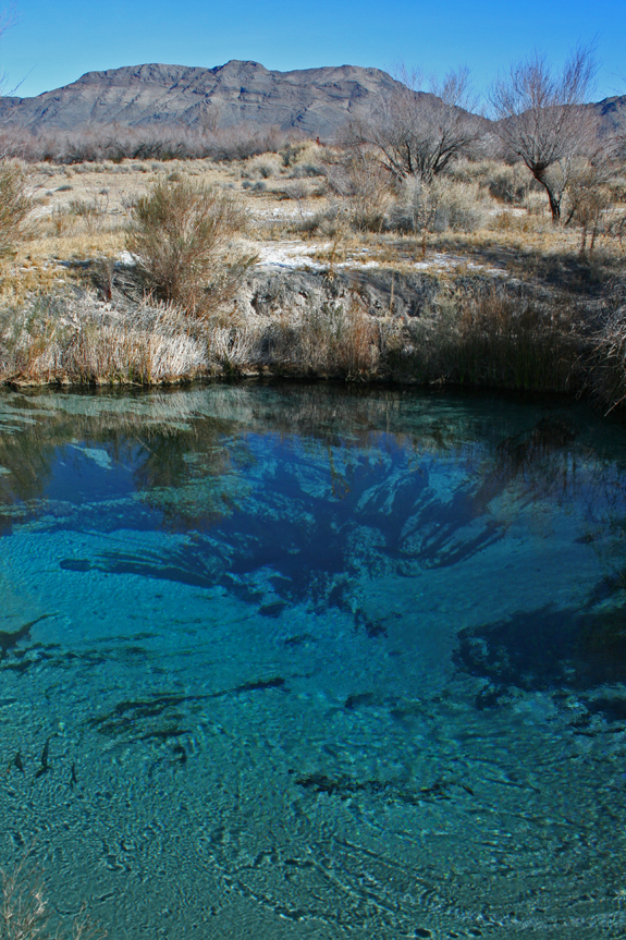
Ash Meadows National Wildlife Refuge is located along the eastern border of Death Valley National Park. The area presents an incredible juxtaposition to the desert — lush springs feed streams lined with riparian species; many of which are relicts of a wetter time. In this arid region, when precipitation befalls the mountains of southwestern Nevada, water percolates into aquifers. Over nearly a millennia this primordial water flows underground; forming the headwaters of the aboriginal Amargosa River. At Ash Meadows, these waters are forced up from the underground and a brilliant system of springs can be witnessed; in the heart of some of the most arid land on earth.
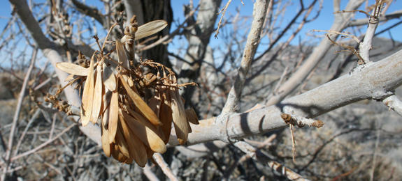
The velvet ash (Fraxinus velutina) for which the refuge is named
In wetter times of the Pleistocene the Amargosa River flowed here, connecting a system of lakes — all the way to the once-massive Lake Manly. This lake is now dry and known as Death Valley. As this system of rivers and lakes dried with time the fish became restricted to where water remained above ground. Today, Ash Meadows holds the bulk of these springs and hence — through speciation events due to geographical isolation — numerous species of pupfish. It is said that AMNWR has the greatest concentration of endemic life in the United States — at least 25 species have adapted to environments in and around the springs. Again, riparian relicts of and epoch gone by.
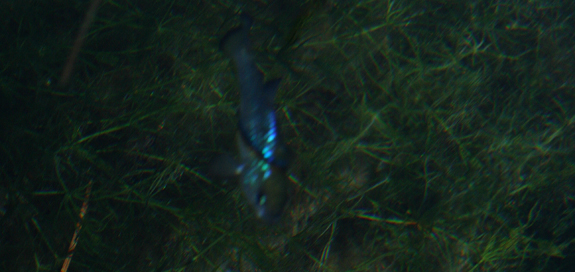
The Ash Meadows Amargosa pupfish (Cyprinodon nevadensis ssp. mionectes) thrive at Jackrabbit Springs.
The pupfish of the region behave as the cichlids of the African Great Lakes — being highly territorial and breeding in a around rocky shelves. Where as the African cichlids are an example of parapatric speciation, the pupfish of Ash Meadows exhibit allopatric speciation — because of their geographic isolation over time.
The region is still threatened. As water levels dropped to feed farms in the 1960’s, the level of water in the underground aquifer dropped and habitat for the Devil’s Hole pupfish (Cyprinodon diabolis) began to disappear. A Supreme Court ruling in 1976 limited the pumping of water and, for now, has saved this species — as the water remains at a level necessary for breeding near a prefered limestone shelf. The Devil’s Hole pupfish, because it lives in only one place — a litteral rock-hole-spring in the middle of the desert — is possibly the most environmentally restricted species on Earth. This area needs us to visit, to foster our understanding of the unique biota living on our planet.
The swirling emerald-blue water of Crystal Spring.
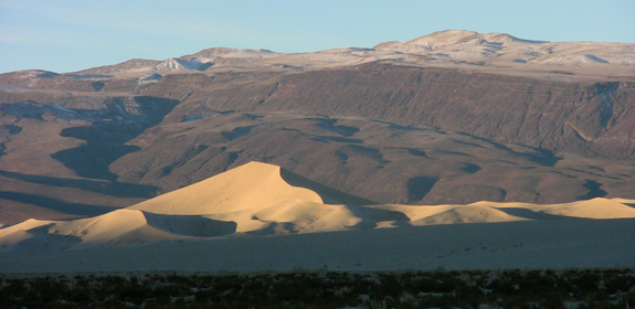
One of the most visually spectacular destinations of all desert landscapes in North America has to be the Eureka Dunes of Death Valley National Park. At the end of the Pleistocene an ancient lake that filled the valley floor gradually dried up; as the winds blew newly exposed sand the dunes formed — into one of the highest in North America. The highest dune in the complex rises to 650 feet above the valley floor from which the surroundings are a terrific spectacle to witness. Another fascinating feature of the dunes is their propensity to sing or boom when the sand is pushed from a steep slip face. The sound reverberates from inside the dune as a deep bass note — which is sure to amaze.
Looking south to the Eureka Dunes and Saline Range at sunrise.
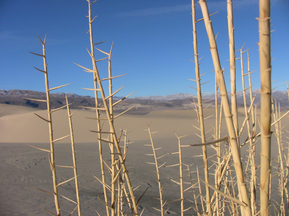
The valley not only offers visual beauty but endemic biota as well — currently 3 endemic plants and 5 endemic beetles have been identified on the dunes themselves. The Eureka Valley dune grass (Oenothera californica ssp. eurekensis) was the most spectacular to find on our winter trip. I had never seen a grass that looks like this — quite primordial indeed. The other two endemic plants on the dunes are shining milk vetch (Astragulus lentiginosus var. micans) and Eureka Dune evening-primrose (Oenothera californica spp. eurekensis). Though we saw the astragulus, both are best viewed in early spring when in bloom.
The endemic Eureka Valley dune grass.
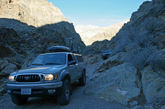
The legendary plant explorers of the Eureka Valley are Mary and Paul Dedecker. As self taught botanists they often explored the Mojave looking for plants. One a fateful day in the summer of 1975 the two ventured into the Eureka Valley and eventually into a canyon on the south side of the valley. It was a hot July day when Mary found a shrub in bloom — bright yellow when all other plants were browning in the summer heat. It turned out the this was a new species and a new genus that favors a rare limestone outcrop in the canyon. She aptly named the plant July gold (Dedeckera eurekensis). The canyon itself was later named Dedeckera Canyon and can be traveled (with 4-wheel drive and experience) all the way to Saline Valley.
Dropping down the dry falls of Dedeckera Canyon from Saline Valley
COMMENT: AUTHOR: Thomas Lopez DATE: 10/8/2009 12:34:22 AM Very nice photos, hope to visit the area sometime for an Ansel Adams experience, that is photographing the dunes and surrounding area with a large format camera and b/w film. —– COMMENT: AUTHOR: Lenavena EMAIL: lenevana@gmail.com URL: https://www.wildlifeworld360.com DATE: 11/1/2010 11:24:58 AM Awesome photos. Will visit it sometime —– COMMENT: AUTHOR: Dave Imper DATE: 11/15/2010 5:56:35 PM Fantastic pics Mike. I took the road between Eureka and Saline Valleys as well, back in about 1997…brutal. Glad I had a rented car. Did you see the Marble Bath, noted on the USGS quad? Not what you expect. We need to share our desert trip photos.
Dave- I have done that road twice and missed the Marble Bath each time–guess it was a bit stressful from Saline to the saddle and I was distracted when we passed that spot. -Michael