Ecological Amplitude: A story of climax

Original Publication DATE: 7/15/2011

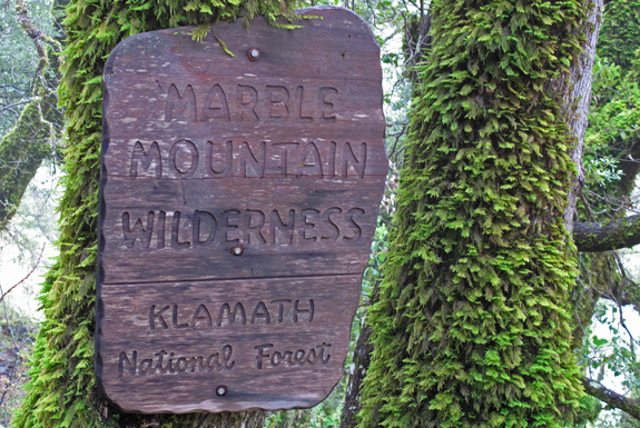
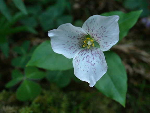
Box Camp Mountain | Marble Mountain Wilderness

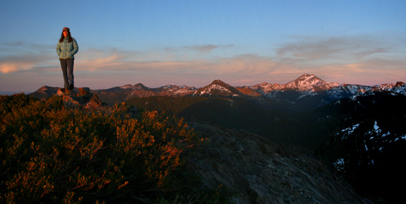
Ecological amplitude is the range of habitats, often dependent on and defined by elevation, within which a certain species has the ability to survive. In the Klamath Mountains there are two species of pines that define the highest elevations–growing at or near the summits of peaks from ~7500′ to 9000′ (The Klamath Mountains get no higher). Foxtail pine (Pinus balfouriana) and whitebark pine (Pinus albicaulis) inhabit our sky islands where they are the crowning jewels of this coniferous wonderland.

IMG_6853
Jeffrey Kane ponders the approach to Box Camp Mountain from the Pacific Crest Trail.

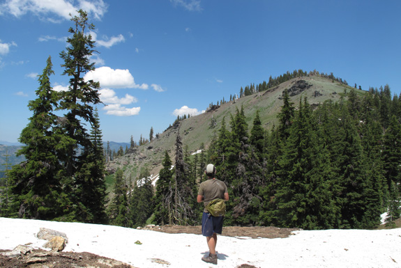
Box Camp Mountain is interesting for several reasons. The first is that its summit is only 7,267′ yet both species of said pines live in this fringe habitat. This is generally on south-facing slopes where lack of competition from firs and hemlocks (which thrive on north-facing slopes) is minimal. When approaching the summit I began to doubt the reports of these pines being here; but in the last few hundred feet they began to appear. Throughout Holocene warming, these two species (and others) have slowly been retreating up  regional mountains. Now, after thousands of years, they have reached their ecological climax on Box Camp–there is no more up on which to grow. This mountain holds the most formidably presumptive story I have attempted to read in a high elevation Klamath landscape–and what I read does not appears to have a happy ending.

Continue reading “Ecological Amplitude: A story of climax”

Red Buttes Wilderness | Recognizing Wild

Original Publication DATE: 7/13/2011

Our adventure began in the heavy rain of late June. We waved farewell to Allison from the Canyon Creek Trailhead to walk the Bigfoot Trail–in search of wild plants and places–for two weeks. As we climbed into the Trinity Alps it was doubtful we would be able to hike very far because of heavy snow and high water. On our second day, as the rain cleared, we approached the dangerously swift Stuarts Fork and were, for a moment, stopped by Mountains and Water.

Print
Wet weather, heavy snow at the passes, and swift creek crossing typified the first week of hiking through the Trinity Alps, Russian Wilderness, and Marble Mountains. Bottom left is the crossing of Stuarts Fork in the Alps–without that log, the trip would not have happened.


Continue reading “Red Buttes Wilderness | Recognizing Wild”

Wild and Wooley

Original Publication DATE: 4/17/2011

It has been several years since my last visit to Wooley Creek. This was far too long. The Salmon River Country is magical and I was fortunate enough to find some magic this wet northern California weekend when I spent the night along one of my favorite California creeks (Check out Gambolin’ Man’s take on my other favorites). Wooley creek roared as it funneled past the trail and my camp–draining hundreds of square miles of Marble Mountain Wilderness. It would soon enter the Salmon River, briefly, before merging with the mighty Klamath River on its way to the Pacific Ocean. It felt like spring as flowers and bud were popping in the wet (and mildly warm) conditions. The mixed-evergreen forests of the Klamath Mountains are waking up.

Marble Mountain Wilderness
Entering the wild and wooley wilderness

Continue reading “Wild and Wooley”

A day at Bear Basin Butte

Original Publication DATE: 2/7/2011

During this extended period of phenomenal weather, we packed our weekend bags to rough it on the edge of the Siskiyou Wilderness. Nearly ten years ago to the day, I pursued this route to reach Clear Creek in the wilderness, a new transplant to the Klamath Region. Had I known there was a cabin en-route that I could  have rented, on the top of a mountain and in a botanical area no less, I may have never properly understood the hardships that weather in northwest California could offer the winter traveler. On that particular trip I endured snow and rain for four days, alone in Bigfoot country–meeting my first Brewer spruce, Port-Orford cedar, and Darlingtonia. I came in from the wilderness a creature void of form.

However this February 2011 weekend, surrounded by friends, it was mostly sunny with a strong chance of incredible.

Bear Basin Butte
Allison braves the cold winds to revel in a sunset over the Pacific Ocean with views to the Siskiyou Wilderness.

Myrtle Creek Botanical Area | Six Rivers National Forest

Original Publication DATE: 3/17/2010

Situated on the border of two major rock types, Myrtle Creek Botanical Area is floristically challenging as well as aesthetically arousing due to this unique geological architecture. Along the western slopes of the Myrtle Creek drainage, the North Coast Range meets the Klamath Mountains against an ancient island-arc accretion known as the Josephine Ophiolite. Plant communities are often defined by rock type, and this juncture creates unique plant assemblages. It is a place where complex rock interacts–nutrient rich soils of Coast Range meets the nutrient poor serpentines of the Josephine Ophiolite. It is also a place where ample rain falls, often in the amount of 100 inches per year. Because of these complex abiotic interactions, plants touch roots with plants in associations that almost never occur. For example, redwoods (Sequoia sempervirens) grow with pitcher plants (Darlingtonia californica) and western redcedars (Thuja plicata) with knobcone pines (Pinus attenuata).

Historically, the drainage saw major mining operations transform the landscape when placer mining (panning) in the late 1800’s gave way to the more destructive–and potentially more lucrative–hydraulic mining during the early 1900’s. Eventually, all the accessible gold was removed and as the miners left the landscape, it slowly recovered. Today, all that remains from the operations is a major sluice where the trail begins, a ditch upon which the trail is built as well as several old shafts that are fenced in for protection.

The plants have returned and, with a few exceptions, are flourishing. The wildflowers begin in mid-March and continue into early June. Orchids, trilliums, azaleas, rhododendrons, mustards, buttercups, sorrels, wood roses, huckleberry, and more create a rare botanical legacy of unique associations–ready for exploration and self-discovery. Located within the Smith River National Recreation Area, the trail has interpretive signs to aid your discoveries along the 1+ miles to the creek.
Myrtle Creek Botanical Area
Map to Myrtle Creek Botanical Area in the Six Rivers National Forest.
Pseudotrillium rivale
Brook wakerobin (Pseudotrillium rivale)
JosephineOphiolite037
Myrtle Creek
Darlingtonia californica in Del Norte County
Darlingtonia californica (by Allison Poklemba)

Pictured above is California pitcher plant (Darlingtonia californica) growing on serpentine, which is not unusual in Del Norte County. What is unusual is that along Myrtle Creek it associates with salal (Gaultheria shallon) which is in the picture and growing just above–casting shade–is a redwood tree. 

JosephineOphiolite045a
Anemone quinquefolia
Other Resources:
  1. North Coast CNPS Page for Myrtle Creek Botanical Area

—–
COMMENT:
AUTHOR: Sue
DATE: 4/24/2014 4:18:08 PM
You said: “… a ditch upon which the trail is built…” This was no ditch, but a carefully constructed Chinese Footpath – the kind a person would see in Vietnam, Cambodia, Laos, or other Asian rainforest areas. In addition to a mining camp was a Chinese labor camp. They built the footpath – which used to extend from near the falls to what is now hwy 199. I have taken several Vietnam Veterans on this trail, and they are all amazed at the similarity between this “ditch” (as you call it) and trails they saw while in Vietnam. These Chinese trails are noted by drainage area on the ‘mountain’ side of the trail, and a berm on the “creek” side of the trail. This construction helps keep the trail intact despite wet weather. Unfortunately, after over 150 years, there have been some serious mudslides along the creek that covered portions of the footpath – making it very difficult to get to the falls. There are still gold mining claims along the creek, and in the past, these mining claims have been protected with rifles. But not any more. I love this creek, have hiked it for 40 years, and treasure the botanical life. But a well-maintained trail would be nice. I would love to be able to hike to the falls again on a real trail.

Sue- Thanks for the comment. Sounds like you have a great understanding and appreciation for this wonderful creek canyon. I am sorry if I offended you by calling it a ditch, I know better now! -Michael